Three weeks ago, I went on a hike with some friends up to
Castle Rock, a tall rock formation about 3 miles northeast of McMurdo Station. It looks a bit like a miniature
Devil's Tower and it rises about 500 feet above the island. There's a trail to the top from which we could see quite a ways. I took lots of photos, posted below, so enjoy!
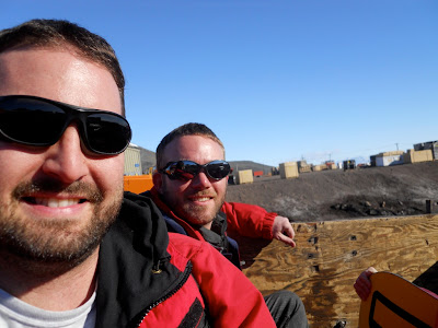 |
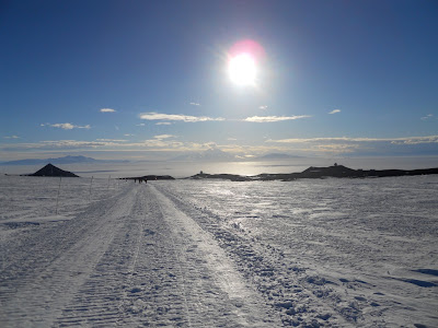
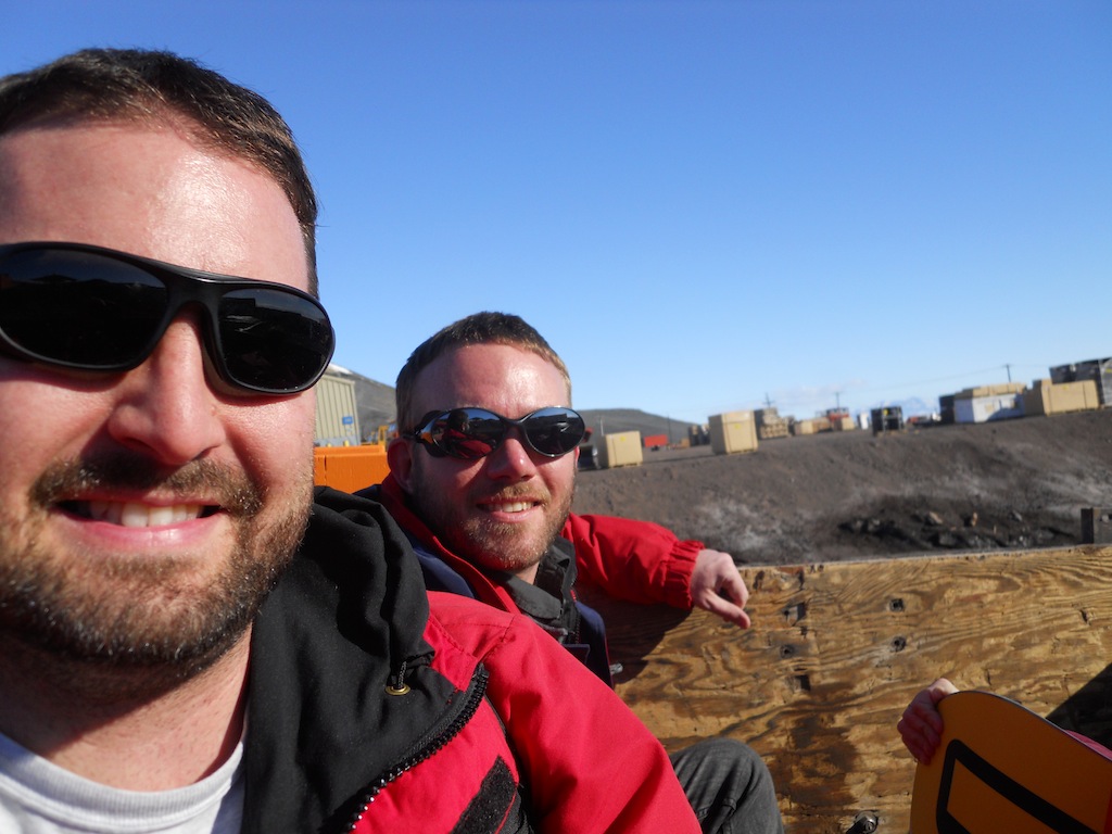
| Deke and I rode in the back of the truck on the way to the trailhead. It was a beautiful, sunny, warm (mid-40s) day... perfect for a hike! |
 |
| Mt. Erebus steaming in the background. If you look closely, you can see the moon just above and slightly to the left of the volcano's peak. |
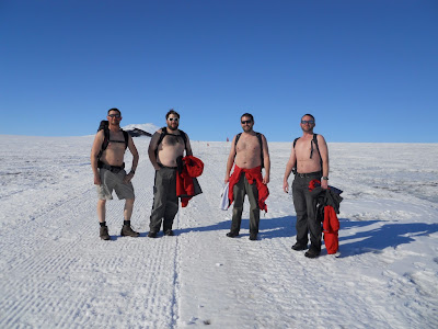 |
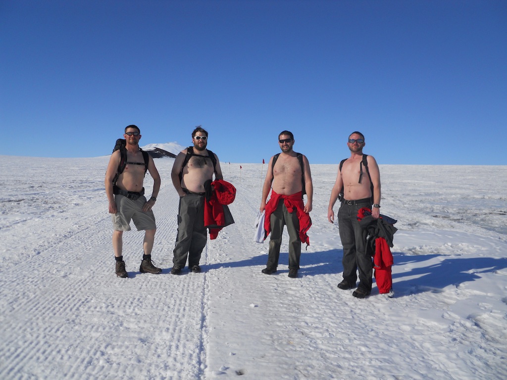
| It was a warm day! All four of us guys (Ed, Roy, me, and Deke) were sweating a lot hiking up hill in the blazing sun, so we found an efficient way to cool off. :) |
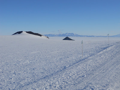 |
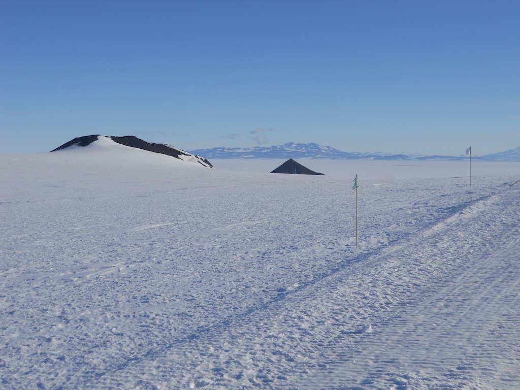
| Looking behind, Ob Hill stands in the distance looking very much like a pyramid. |
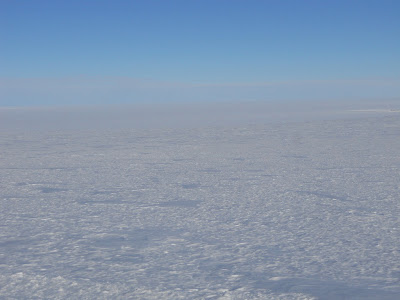 |
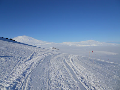
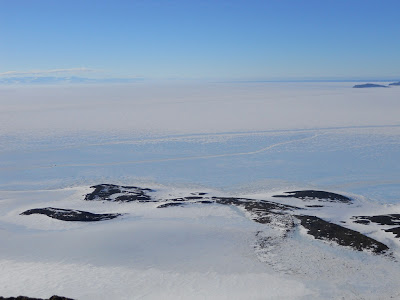
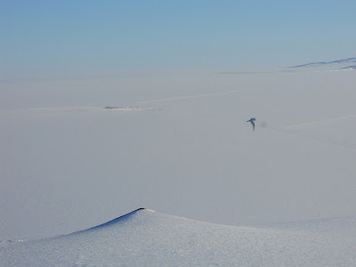
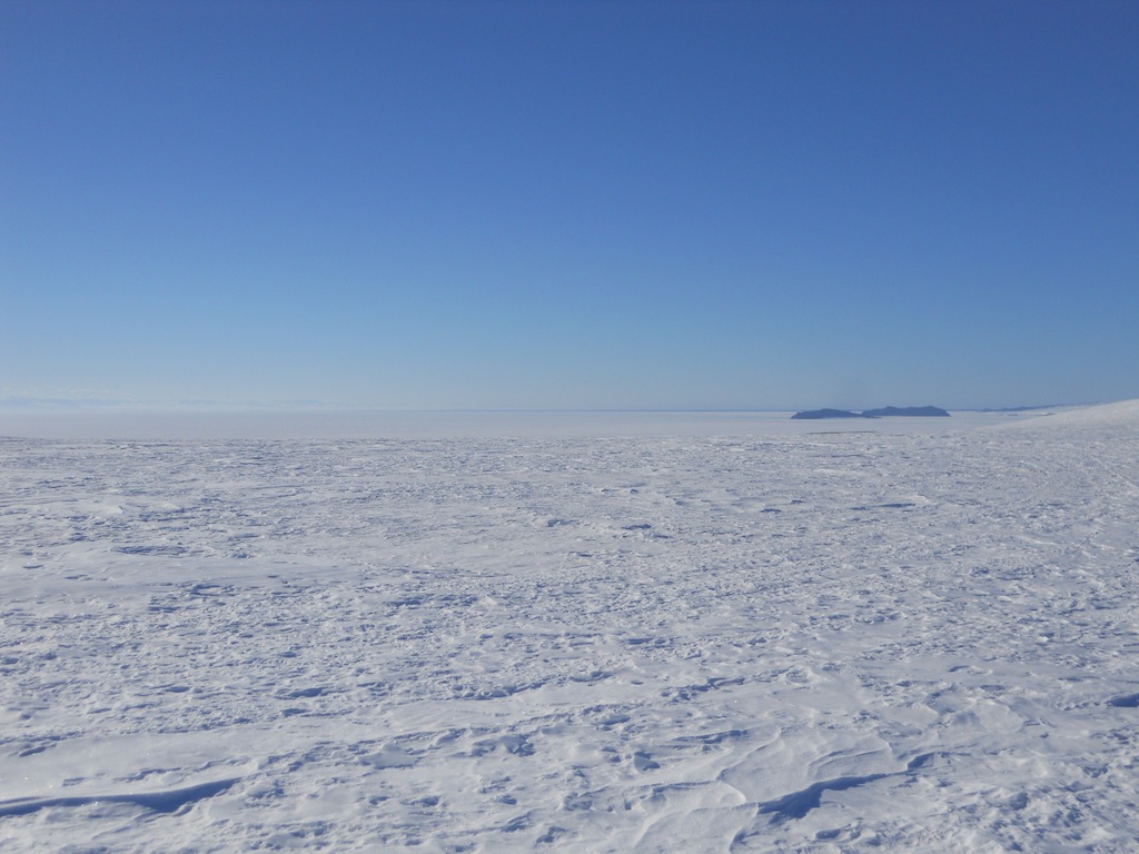
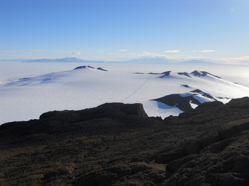
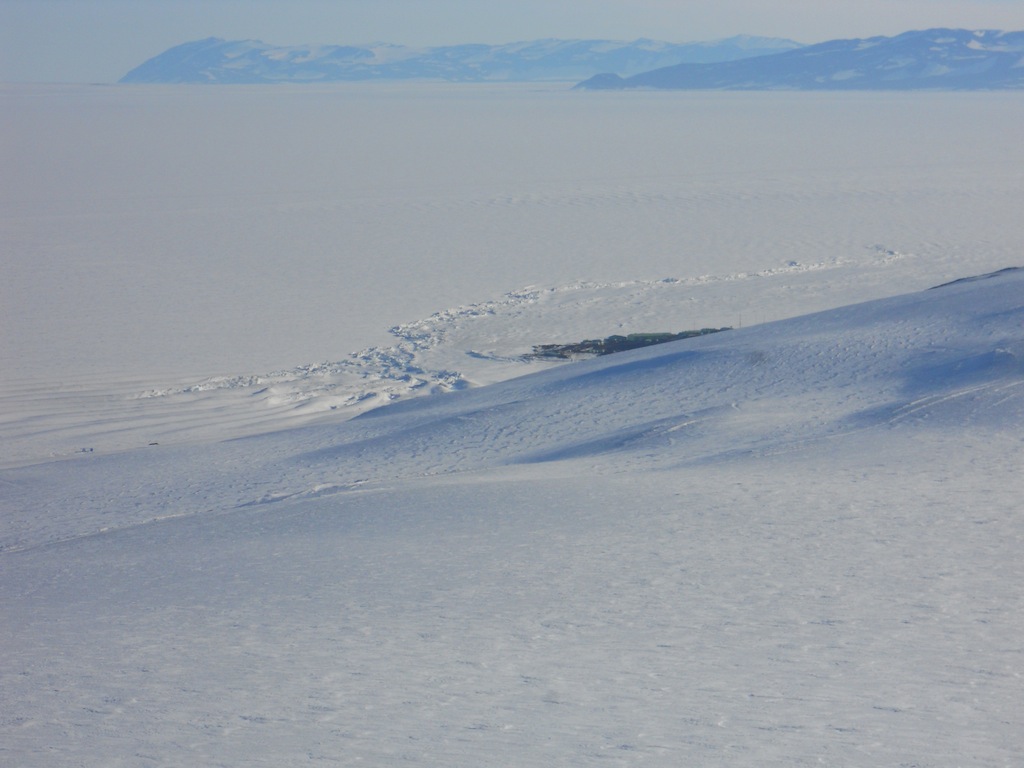
| Looking south, one could see the vast stretch of empty whiteness. The textured white in the foreground is the ice sheet on Ross Island; the smooth white in the background is the Ross Ice Shelf. |
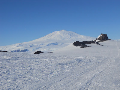 |
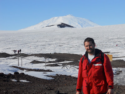
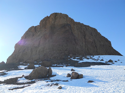
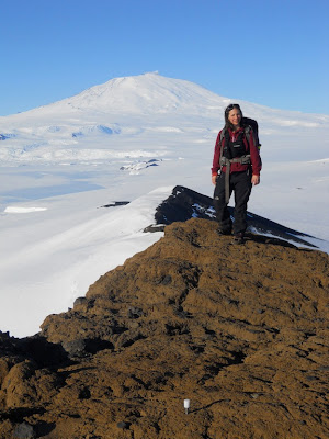
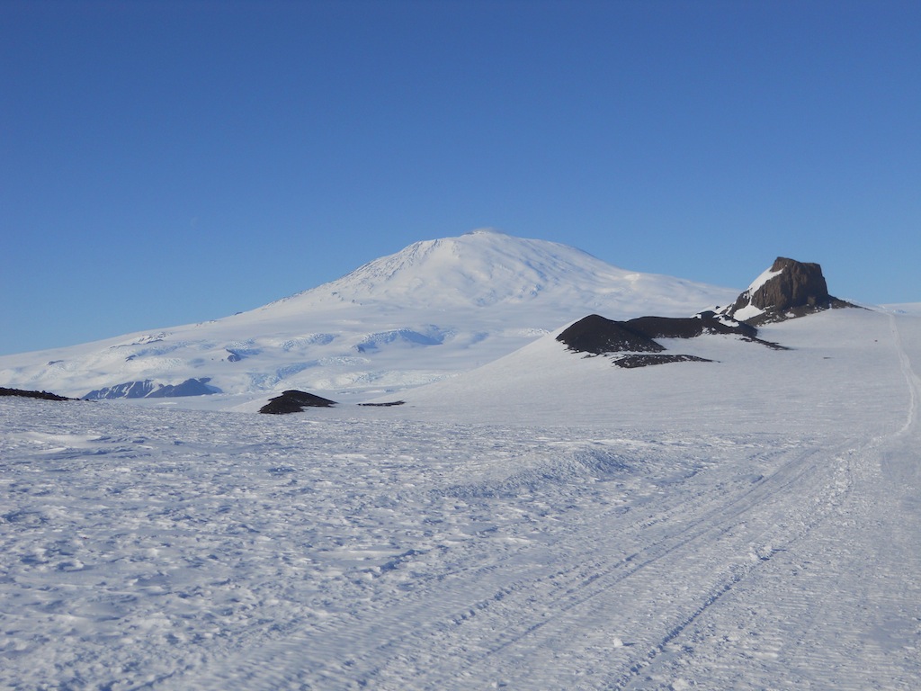
| Mt. Erebus and Castle Rock |
 |
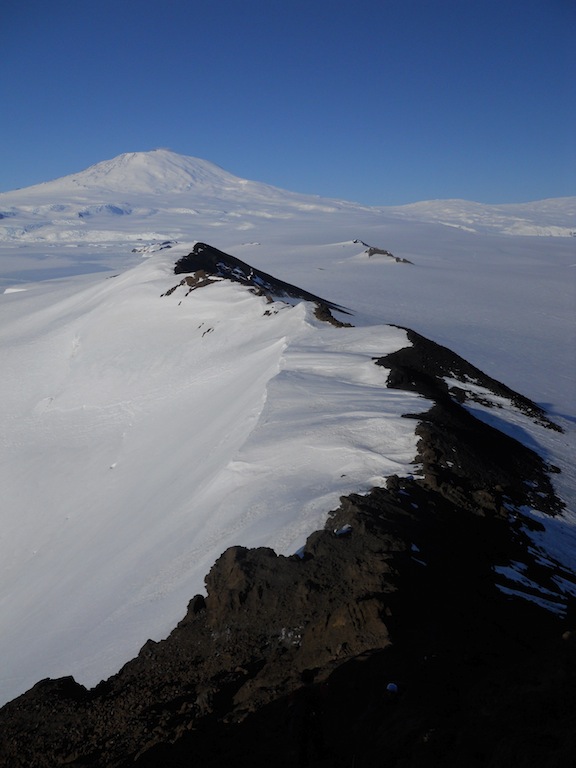
| The Hut Point Peninsula ridge line and Castle Rock with Mt. Erebus in the background. |
 |
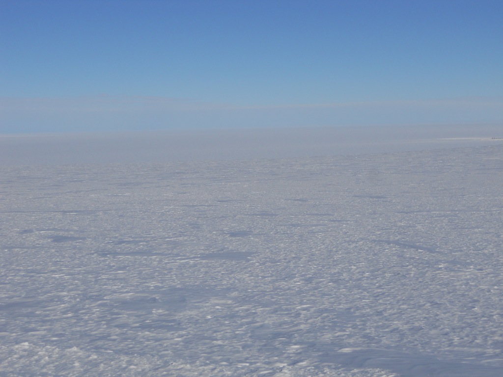
| Looking north, you can see the receding sea ice on the horizon. The thin blue line behind the islands far away is liquid ocean. |
 |
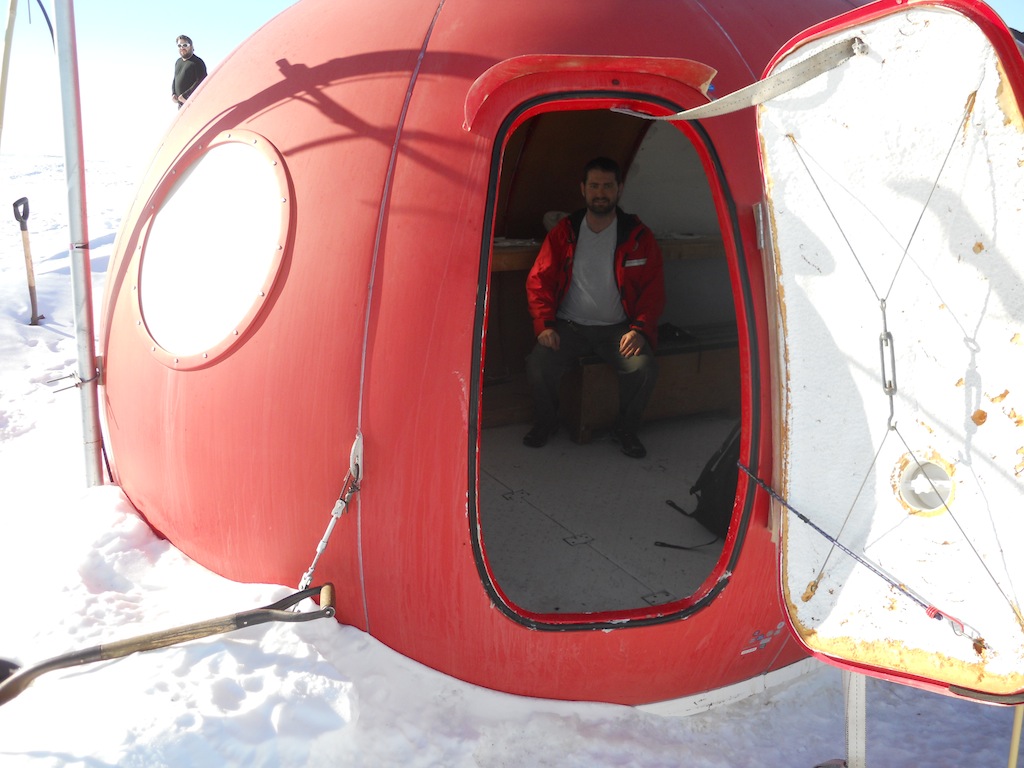
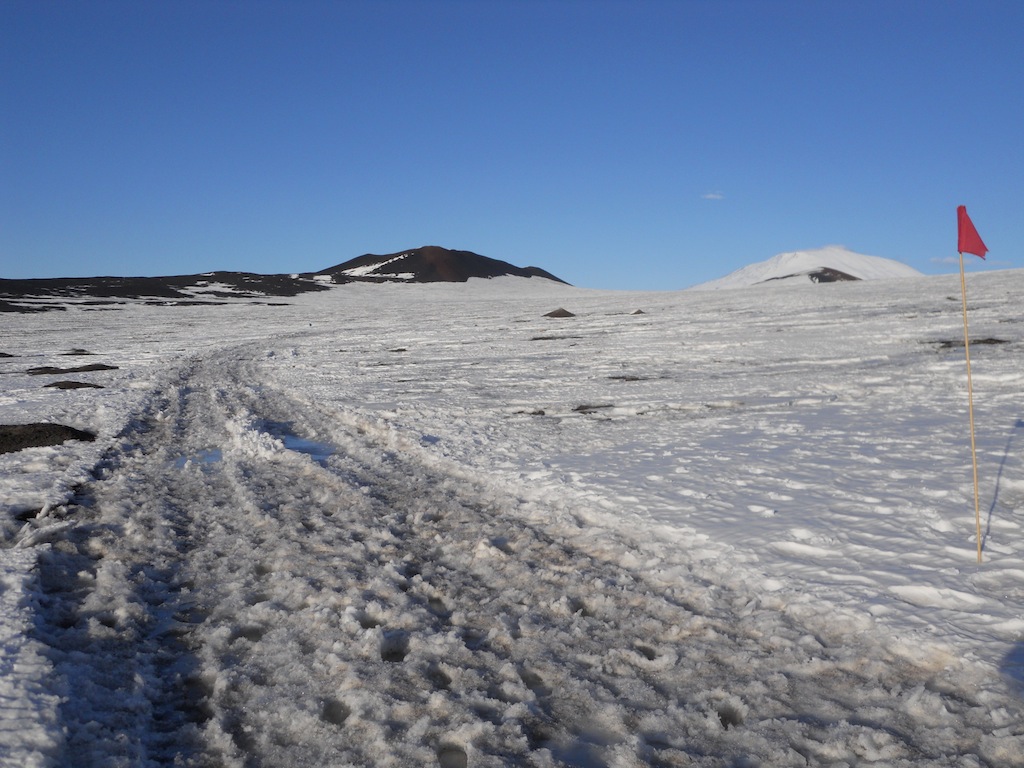
| Along the trail were two warming huts, a.k.a. apples, to provide hikers a place to warm up and take a break. Since it was already warm outside, we didn't really need to stop here, but I did change my socks since they got wet early in the hike. |
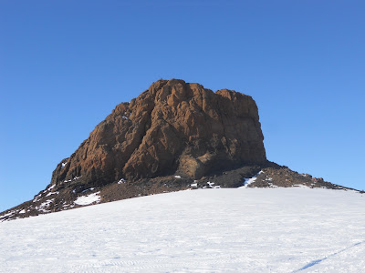 |
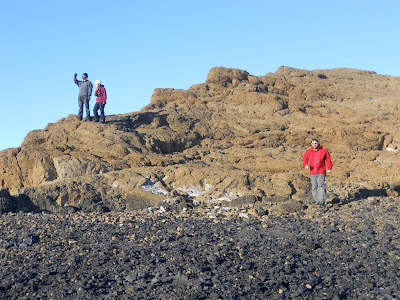
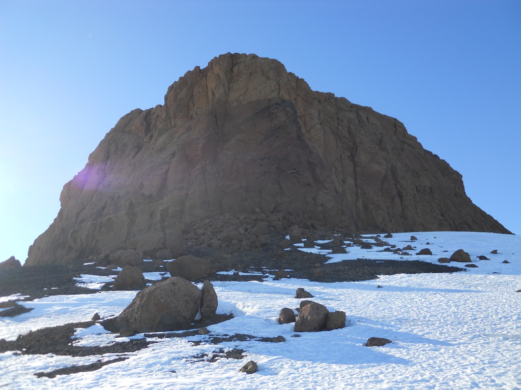
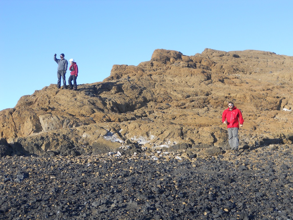
| Castle Rock is a different color than the normal black volcanic rock of Ross Island. |
 |
| Another view of Castle Rock. |
 |
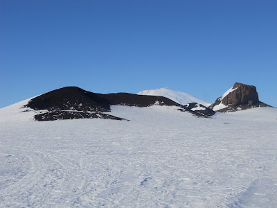
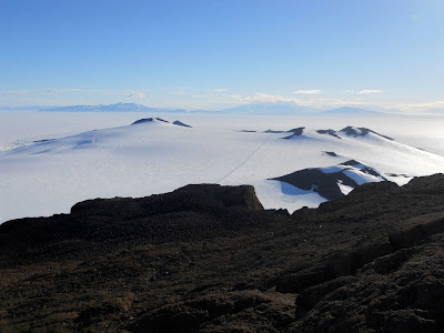
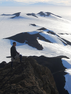
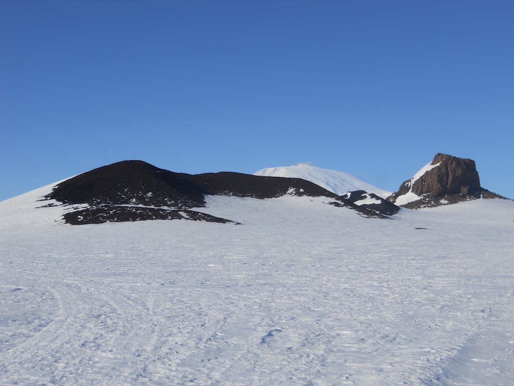
| Behind Castle Rock in the distance are the three peaks of Ross Island: Mt. Erebus, Mt. Terra Nova, and Mt. Terror. |
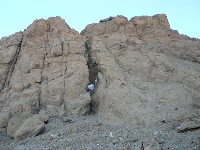 |
| A big crack in Castle Rock. |
 |
| Ed takes a picture of me taking a picture of Ed. |
 |
| The Hut Point Peninsula ridge line continues from Castle Rock towards Mt. Erebus. |
 |
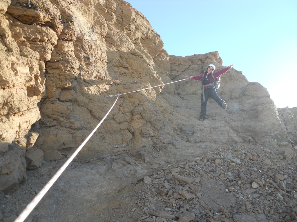
| Cheryl was excited to climb to the top of Castle Rock. The rope was installed to prevent slips and to help hikers climb over some of the more precarious ledges on the way up. |
 |
| Cheryl made it safely to the top. :) |
 |
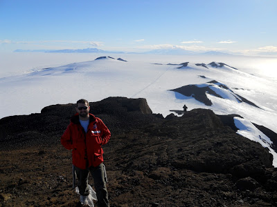
| Looking west, Mt. Discovery stands in the distance, enshrouded in clouds. The black rock in the foreground is the top of Castle Rock. The point of Ob Hill can be seen in the middleground to the left. |
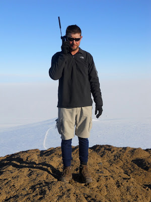 |
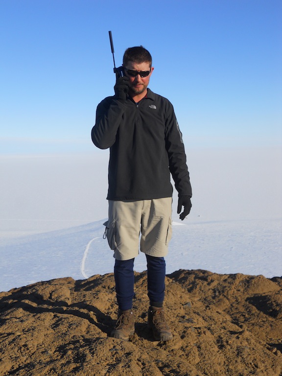
| Using an iridium phone, Ed called his wife at home, waking her up in the middle of the night. |
 |
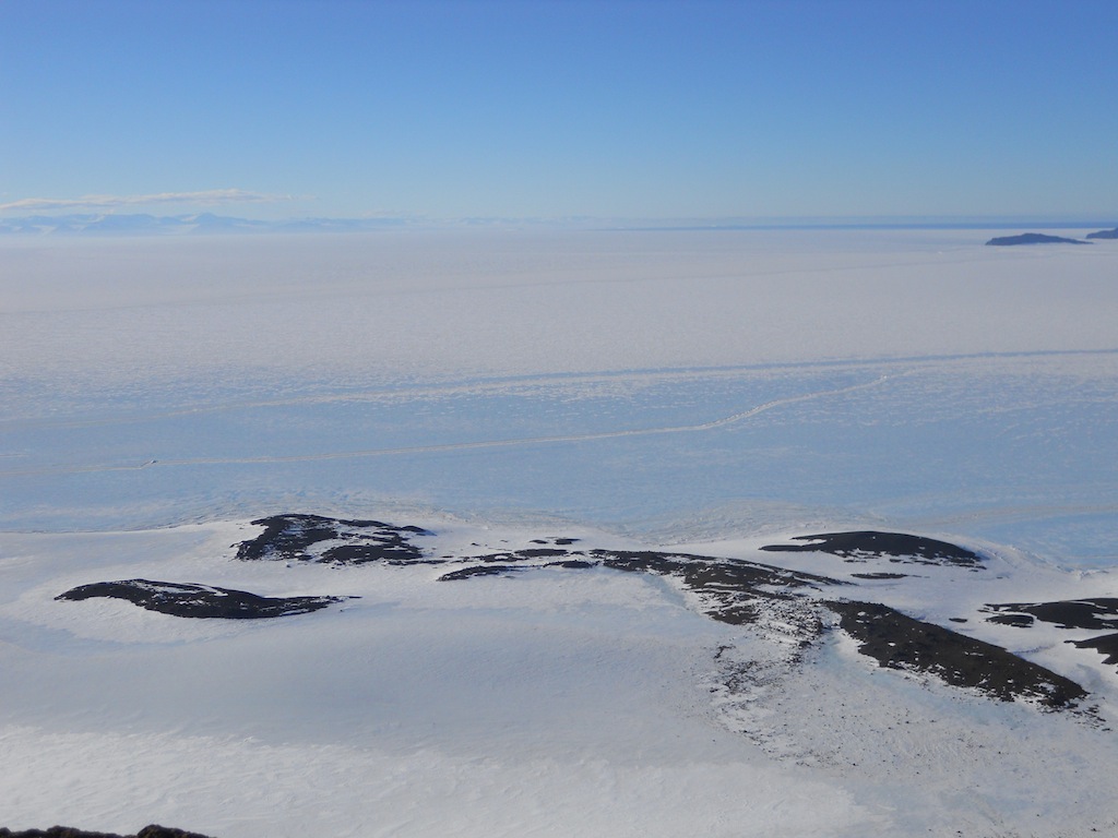
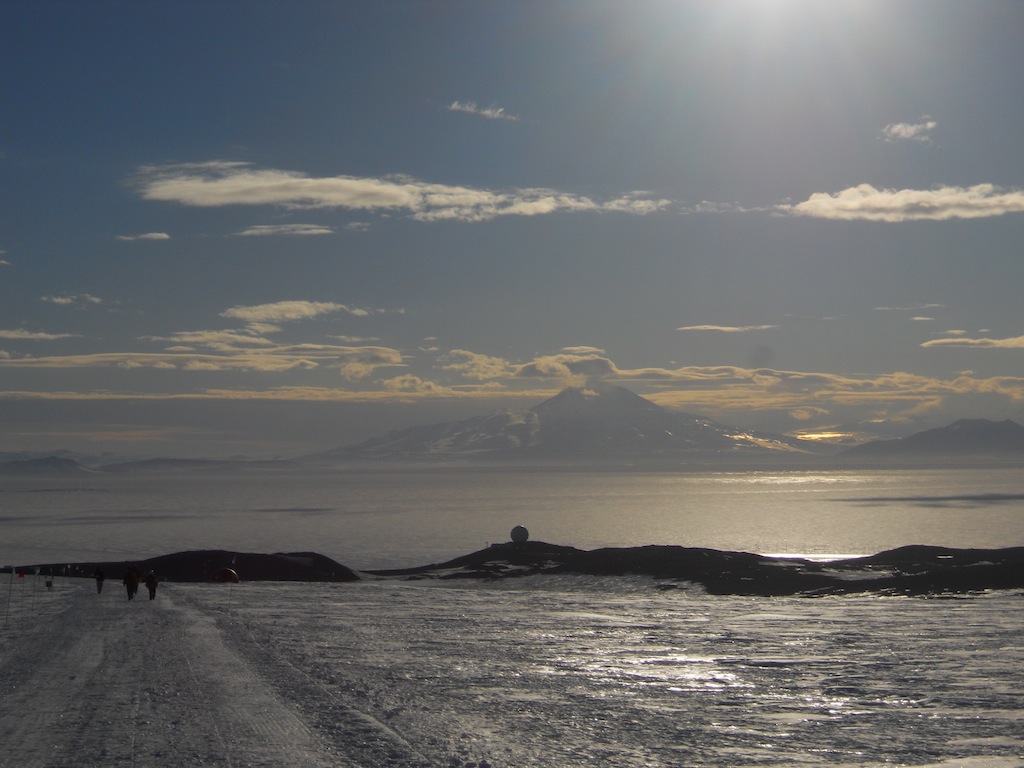
| The green buildings in the middle of the photo are Scott Base and the ripples in the ice are the Pressure Ridges, the place where the Ross Sea meets the Ross Ice Shelf. The darker mountains in the background are Black Island and the fainter ones are the Transantarctic Mountains. |
 |
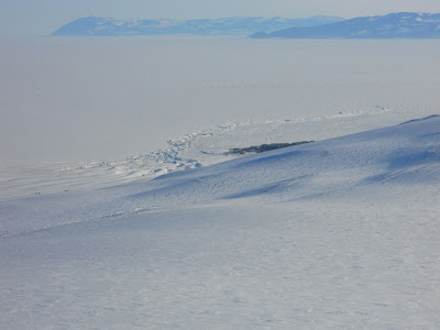
| A view to the north where an enormous crack runs through the sea ice; off in the distance, the ocean is visible. I was able to see some icebergs floating in the ocean, but unfortunately the camera didn't pick them up. |
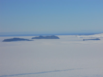 |
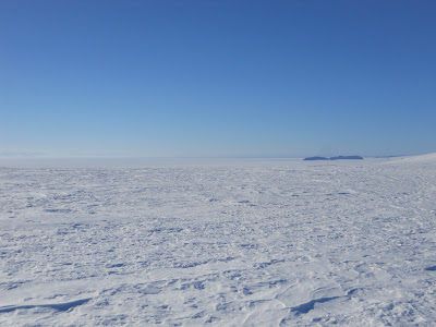
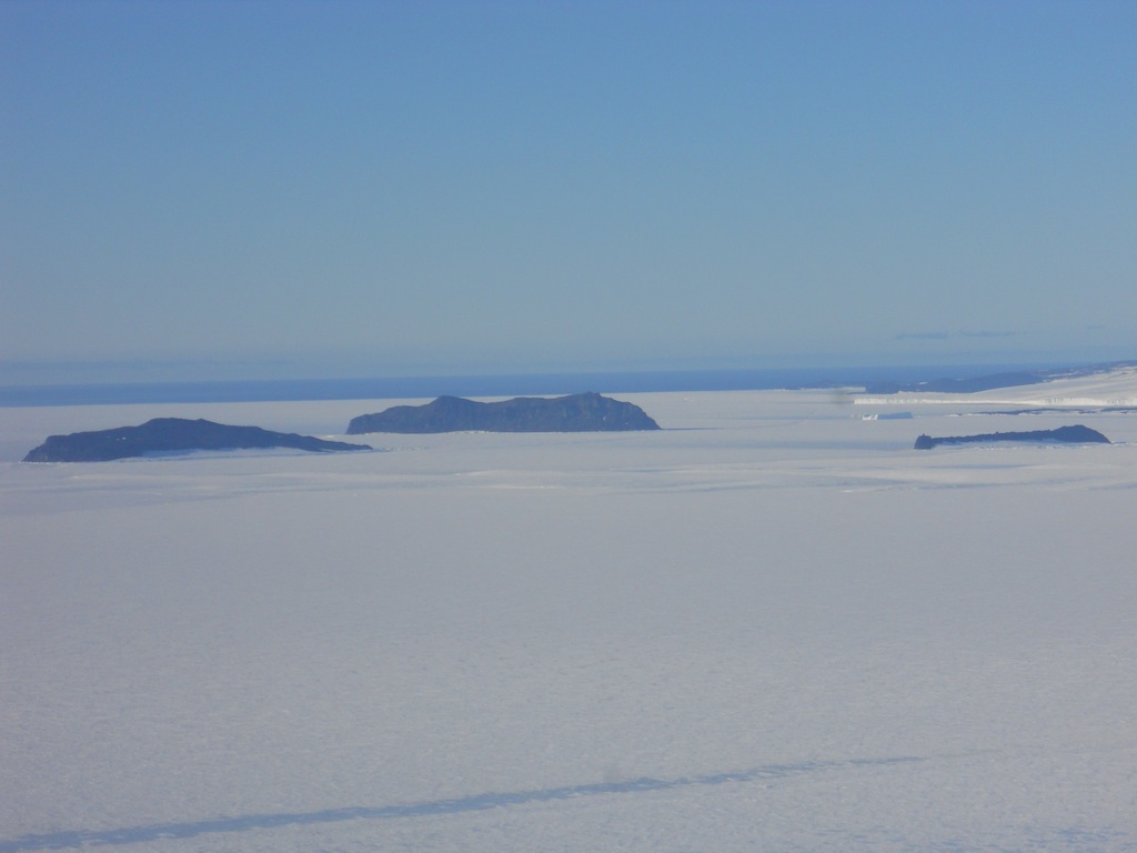
| Islands in the Ross Sea north of McMurdo. To the left are Tent Island and Inaccessible Island, and to the right are Big Razorback Island and Little Razorback Island (they look as if they're one island from this point of view). Just past the Razorback Islands on the left is an iceberg stuck in the sea ice and behind all of them is the blue ocean! |
 |
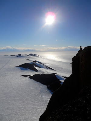
| I made it to the top! |
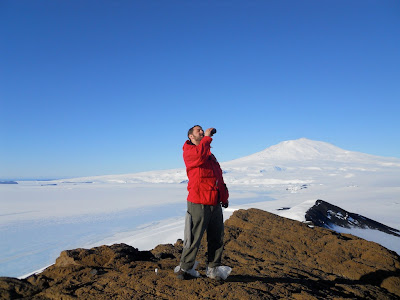 |
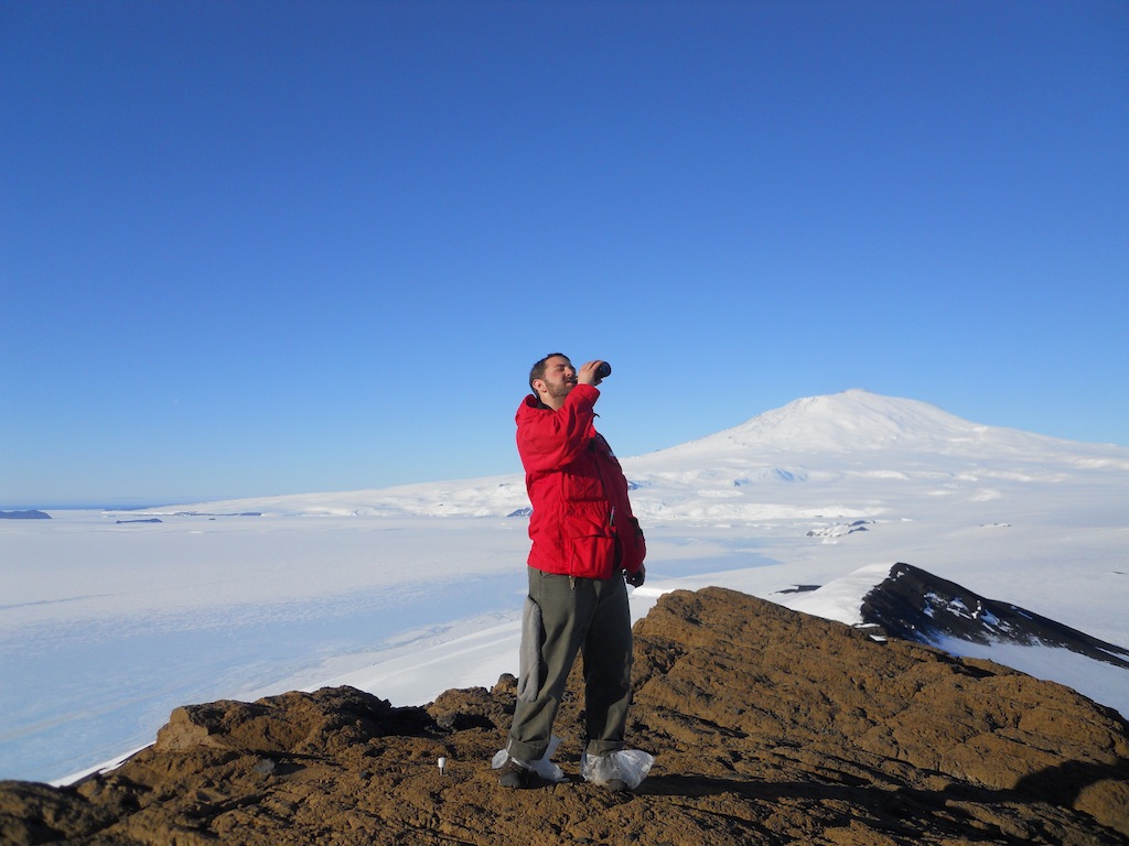
| There's nothing like a cold ginger beer to quench a big thirst. :) |
 |
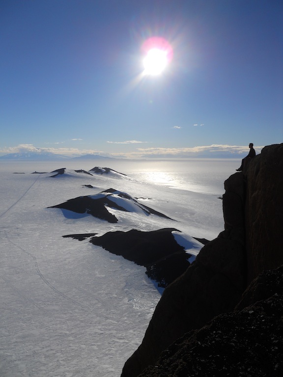
| Ed looks out from the top of Castle Rock with the Hut Point Peninsula in the background. |
 |
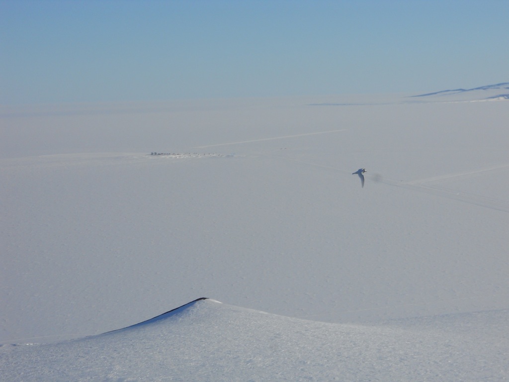
| Some birds flew by us while we were on top of the rock!! I think they were Antarctic terns, and they came within about ten feet of me. :) |
 |
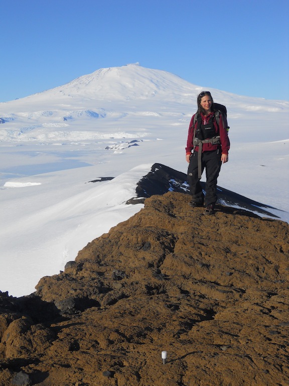
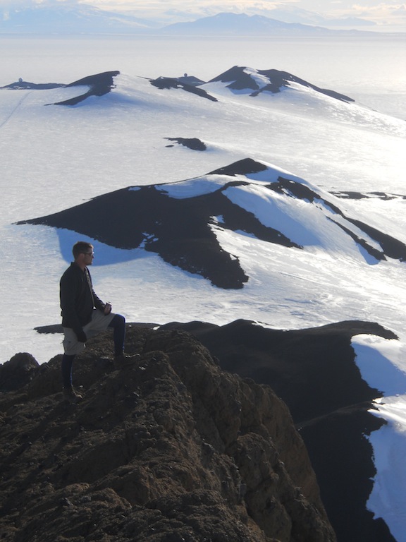
| Me on top of Castle Rock with Hut Point Peninsula and Mt. Discovery in the background. |
 |
| The sun reflecting off the sea ice. |
 |
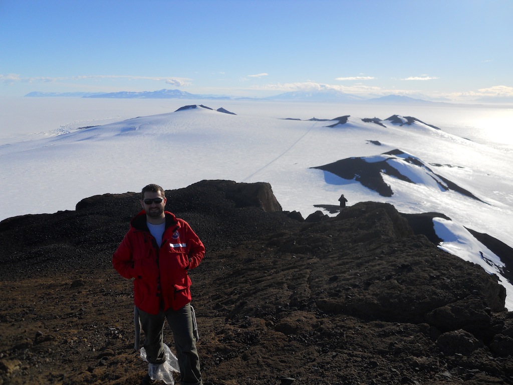
| Deke, Cheryl, and Roy on top of Castle Rock. The black rock is very similar to the rest of the rock found on Ross Island; the brown rock is unique to Castle Rock. |
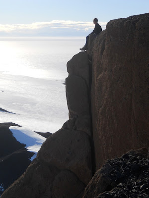 |
| Ed looks out over the Ross Sea. |
 |
| Ed under the sun looking out over the peninsula and sea. |
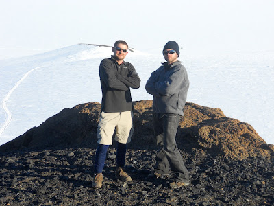 |
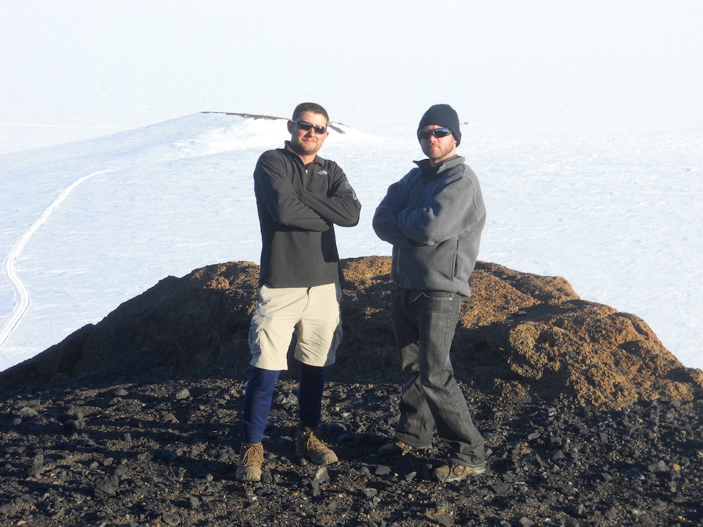
| Ed and Deke |
 |
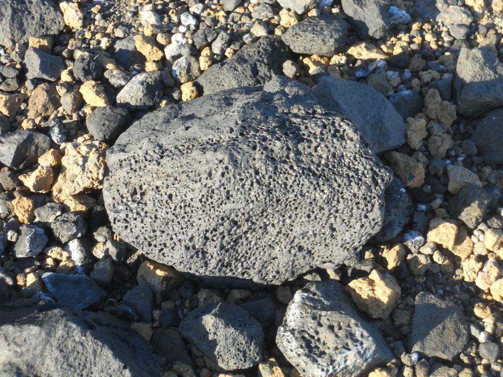
| A sample of the volcanic rock found on top of Castle Rock. |
 |
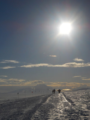
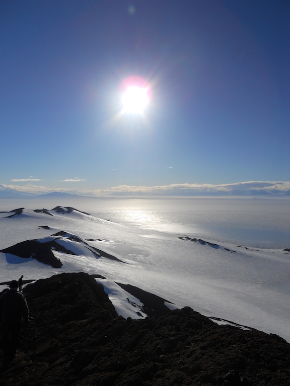
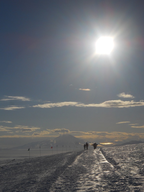
| My favorite time of day is late evening, when the sun is behind the Transantarctic Mountains and reflects off the ice sheets and sea ice to the west. The wind also tends to be calm at this time of day, so it feels very peaceful. |
 |
| Another view of the sun in the western sky. |
 |
| Mt. Discovery and Arrival Heights (the little ball on the hill). |
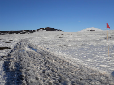 |
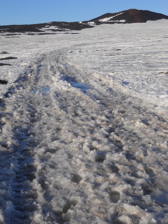
| Earlier I mentioned that I changed socks because my feet got wet. Well, here's where that happened. The trail started out on dry land but soon went onto the ice sheet. The transition area, pictured above, was made up of a lot of melted ice and water, most of which was about one to two feet deep. Even though I wore my waterproof shoes, they did me no good since my entire lower leg plunged into water. |
 |
| Lots and lots of slush. |
The sun reached its highest point in the sky on December 22 and has slowly begun to sink back towards the horizon. We've gotten a blast of cold weather over the last week and today I awoke to snow falling outside! (The only time in my life I've seen snow right after the summer solstice!) There are eight weeks left in the Antarctic research season. The last flight leaves on February 25; anyone still here after that will be staying until at least mid-August. I've got a job interview later this week for a winter position, and I also have to physically and psycologically qualify to stay. I've already done my physical evaluations and I'll be taking the psychological exam on Thursday. If I secure a job quickly enough, there's a possibility of getting a few days of rest and relaxation in Christchurch, New Zealand before the winter season begins. I'm keeping my fingers crossed that everything will work out that way. :)
Happy New Year!


Hi, Joseph - I'm really enjoying seeing your pics & reading about your experiences. I literally just stumbled over a job announcement for next summer for down there...and then remembered that you had this blog that I'd seen linked to FB. SO. Checking it out. I'm moving back to CO next month (for family reasons - my mom is pretty sick), but I don't have a job yet...and this *does* get one to thinking...but then, I need to spend some time at home, first. You never know, though...I might just end up down there one day :) Happy 2011! - Katy D.
ReplyDeleteVery cool - glad to see you getting out & doing some hiking!
ReplyDelete